

nickvet419
-
Posts
7 -
Joined
-
Last visited
nickvet419's Achievements
")
KIC Tourist (1/13)
10
Reputation
-
wikipage = updated
-

Is Oktoberfest being removed from the park?
nickvet419 replied to italianchef's topic in Coming Attractions
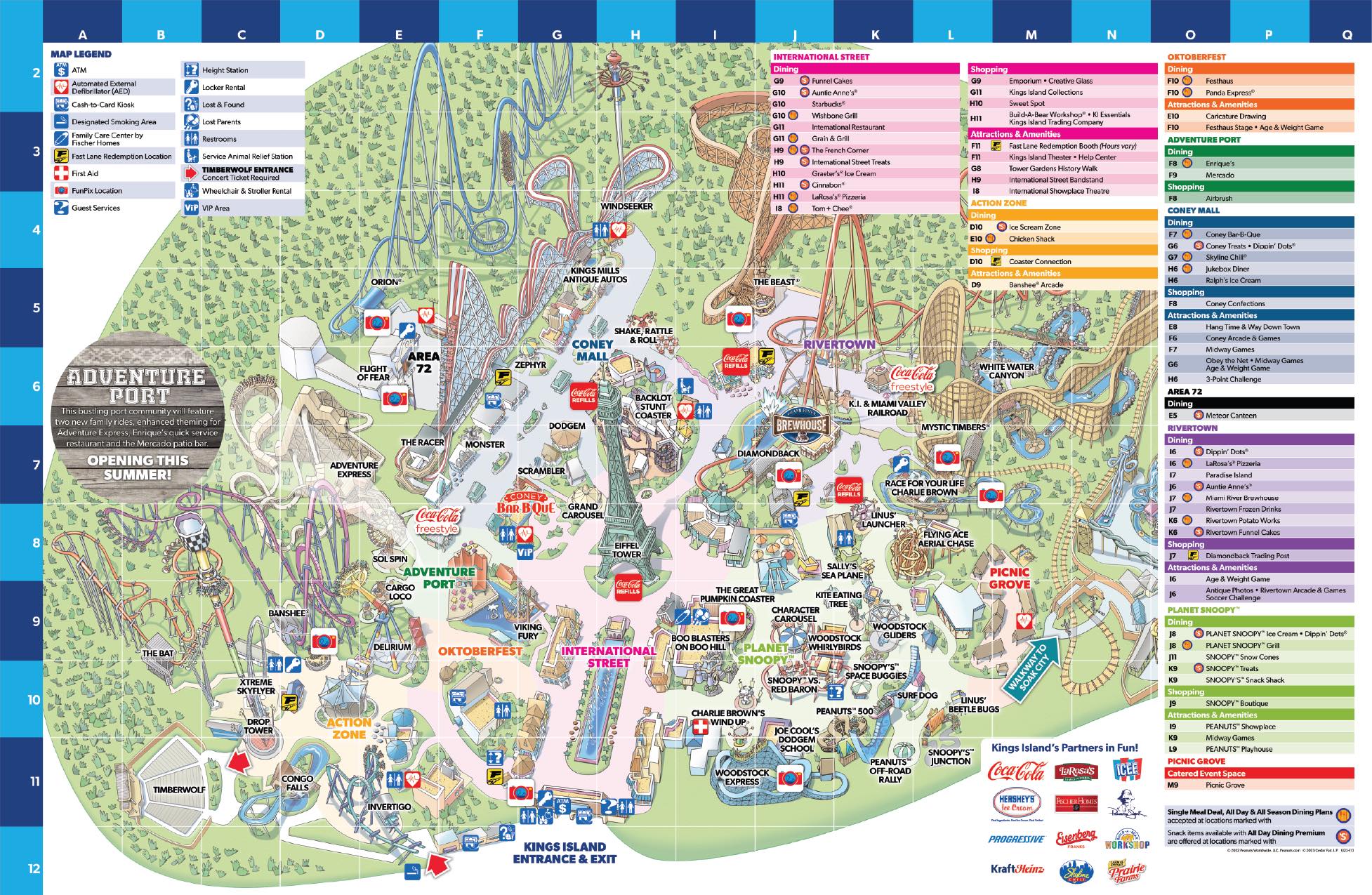
according to the new map that was just released, https://qr1.be/SX1M No! Oktoberfest will be split in two. the west section with Festhaus and the pirate ship ride will remain, the East section will be rethemed as Adventure Park.
-
Not at the park but just down the road.. https://www.daytondailynews.com/news/334-site-outdoor-resort-camping-planned-near-kings-island/uCdTz7ruJRgQEnEAbp5XYK/
-
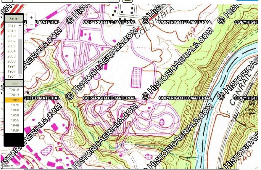
As for a historical fact the "One Team Village" is being built on the old overflow area of the campground. which can bee seen in a old aerial image here https://www.historicaerials.com/location/39.349440251806776/-84.26085591316223/2004/17 For facts on the campground itself. It used to include the area that Animal safari was installed. as seen in the topo map here https://www.historicaerials.com/location/39.349232838051336/-84.26118850708008/T1976/16 The remainder of the campground "Area north of columbia road" was the only section sold to Great Wolf Resorts.
-
Its an community driven open-data mapping site. like the wikipedia of maps. It's used for humanitarian crises, government websites, and even the maps displayed on facebook check-ins. https://www.openstreetmap.org/about
-
The past few days I've been working on updating and detailing the openstreetmap of KI. What ya think so far? KI on OpenStreetMap https://www.openstreetmap.org/#map=16/39.3427/-84.2667
-
The area they are building on , Parcel Number: 16172000120, was used last as the KI campground overflow lot. But I'm wondering what was built on Parcel Number: 16172000050? The main camp area was to the north of columbia road and the southern area that was part of the campground before Lion Country Safari was put in. The Topo map shows possibly a new water reservoir?